Pivoter pour une meilleure lecture


Quito
Like yesterday, we woke up at 5:30 in the morning by groups of joggers!!!
But this morning there are also several street vendors who set up their stalls ... It’s Saturday and the park is filling up as we go along.
The whole quito comes here walking, running, dancing, cycling or playing football in a group, family or alone.
We attend the installation of several aerobics courses with their loudspeakers at the highest decibels.
We decide not to go back to the historical centre but rather to visit the surroundings.
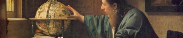
On the heights of Quito, we discover the "Capilla del Hombre" museum and art gallery designed by the Ecuadorian painter Oswaldo Guayasamin.
It traces the entire history of art from Latin America, from Mexico to Patagonia, pre-Columbian and contemporary. The architectural complex consists of two buildings.
The main and most emblematic is the chapel where Oswaldo Guayasamin, of Indian origin, painted huge frescoes on the odyssey of the Latin American human beeing.
The second is its huge and magnificent villa with views over the capital.
The visit is done with a mandatory guide and as often we are too many to follow the explanations of a very patient guide with his flock!!!
We return to the motorhome with a stop in a Greek restaurant (not great) and leave the park which has almost emptied, for storage near the airport.
And yes, tomorrow we will be going to the Galapagos !


Quito
To get to the historic centre we take a very convenient "Metrobus" that connects the north to the south on a dedicated route.
Small visit to the tourist office and our discovery of the capital begins.
With its narrow streets, restored colonial buildings and lively squares, the historic centre invites you to stroll, which we do while visiting among other things:
* Catedral Primada: Located on the Plaza Grande, it houses works by artists from the Quito school and houses the tomb of the hero of independence Antonio José de Sucre. Behind the main altar is a commemorative plaque where President Gabriel García Moreno died on August 6, 1875; after being shot with a machete in front of the Palacio del Gobierno, he was transported, dying, to the cathedral
* Iglesia de la Compañía de Jesús: Topped with green and gold domes, this most richly decorated church in Quito stands out among other Baroque splendors for its Moorish elements enhanced with gold leaf ... It is forbidden to take photos or film inside!!
* Plaza de San Francisco: On this formidable paved square, with the Pichincha volcano in the background, stands the oldest church in Ecuador, with its long lime walls and twin bell towers.
* Iglesia y Convento de San Francisco: Started in 1534, only a few weeks after the founding of Quito, the construction of the monastery, the largest colonial building in the city, was not completed until 70 years later. Damaged by earthquakes, the church was largely rebuilt. The high altar is a spectacular example of baroque sculpture, while the roof is marked by Moorish influences.
We only visit part of the historic center, we keep the rest of it after our return from the Galapagos.
Mitad del Mundo
On the way to the capital on a two-lane road of good quality .... It’s luxury!!!
Along the way we stop at the "Mitad del Mundo" or "Half of the World".
It is here in Quitsato, south of Cayambe, that the French geodetic mission gave the name to the country and calculated the location of this line for the first time ...
We are on the line that separates the two hemispheres ... the real point between the North and the South.
On the ground, a line was drawn to materialize this imaginary separation and thus delimit the equatorial line.
There is another tourist centre in the north of Quito which has not even been well placed, but more organized and larger to accommodate tourists.
We are attending a very interesting special course under a threatening sky.
After lunch we drive to Quito where we park to the north in the "Carolina" district in the park of the same name.
The site of the capital was occupied since pre-Columbian times and the city owes its name to its first inhabitants, the peaceful Quitus.
It had become an important Inca city before the arrival of the Spaniards in 1526. Rumiñahui, a general of Atahualpa, preferred to raze the city rather than abandon it to the conquistadors.
Built on the ruins of the ancient city, the present capital was founded on December 6th, 1534. Along with the settlers came many religious orders (Franciscans, Dominicans, Augustinians, among others), who built churches, monasteries and public buildings, most often relying on the indigenous workforce.
Quito experienced a slow expansion during the 17th and 18th centuries but remained a second-class city by comparison with Lima.
A revolutionary wind blew over the city in the 19th century, and Quito became the capital of the new republic of Ecuador in 1830


Ibarra
In five days we must be at Quito airport to reach the "Galapagos Islands".
It’s time to get back on the road and visit Ibarra.
It was the northernmost city of the Inca empire. Named the “white city,” to distinguish it from the surrounding towns, which were home to black and indigenous communities, it experienced several earthquakes, including the one in 1606 that ravaged the entire city.
It was rebuilt keeping some beautiful buildings of different architectural styles (neoclassical, baroque, neogothic).
We spotted a parking lot near the city center and of course it was not accessible for our companion.
Fortunately we find refuge near a school where the signs to park are very ambiguous ... Let’s see.
We like to ask the tourist offices about the sites and monuments to visit and generally we leave with a more detailed map than those of the paper guides.
This time a charming hostess informs us with a few words in French ... Nice
* Catedral: Baroque style, rebuilt after the 1868 earthquake. The interior is covered by many works of artists trained at the Escuela Quiteña.
* Basilica de la Merced: Romanesque style, it houses relics of saints and the virgin. The altar is gilded in fine gold,
* Museo del Banco Central: It traces archaeological discoveries made around the city with beautiful objects such as pottery or jewellery.
We end the day shopping (mostly warmer clothes)
ROAD BOOK 128


MAVROS ODYSSEE